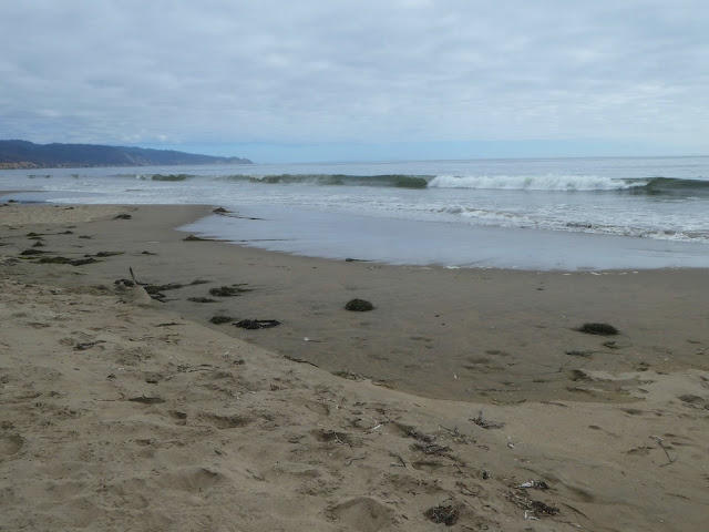
When I go to Point Reyes National Seashore, I inevitably go to a very specific region in the northern part of the park. Generally, it's Drake's Beach and the Elephant Seal Lookout. Generally, it's during Elephant Seal mating season. I've also done the Earthquake trail, something I found when I was looking for that place where the fences were displaced from an earlier quake. But I really had no clear idea of the size of the park, or the diversity it contained. Then yesterday morning, looking for best wildlife trails near me, I found the Muddy Hollow Trailhead. In the long run, we only walked a short distance on that trail. My first plan was to walk the Limantour Spit trail, which turned out to be fairly well overgrown, into the wetlands. We ended up walking along Limantour Beach instead, then turning back. We did do a bit of Muddy Hollow from the Limantour trails, walking along the wetlands parallel to the spit, but didn't go far. We had gotten a late start, and between the increasing clouds in the late afternoon, and the challenge of walking through the shifting sand, it didn't seem wise to take a trail I knew little about except that one hiker reported bobcats and occasional mountain lions were sighted there. The park itself reports that there are occasional Tule Elk, but the website says nothing about predators, so I'm not sure how much I can trust the lone reviewer who claimed to see the cats.
The reason I chose Limantour as the hiking location is that it was on the estuary, and we'd have a choice of three habitats to wander: ocean shore, wetlands, and forest.
The drive up seemed a little nerve wracking, as we wound uphill, with sheer drop-offs, mostly on the other side of the road, which made us dread the drive back. The drive back wasn't as bad as it seemed. And once again, like my previous trips to the region, the afternoon hills and roadside through Marin County were dotted with deer.
The wetlands themselves were a little disappointing, with only a few lone large birds (probably egrets) too far off for my camera's focus, but it was nice to be near water, in a park that wasn't bone dry from the drought.
The tide was rising on the beach, which was dotted with kept wracks and eel grass covered with kelp flies and small crabs caught in the blades like they had been netted, most of which had become feasts for the gulls. There were also jellies littering the beach.
The dunes in this part of the park are covered with native grasses, unlike the dunes at Bodega, which are covered with invasive ice plant. We did see a few patches of ice plant on the Limantour Spit trail, but I suspect that if the trail is cut back again, they will also remove the ice plants.
 |
| pelicans fly above the dunes at Limantour Beach |
Having driven Limantour Drive both ways now, I am less anxious about the road, and may want to go back and do the Muddy Hallow Trail, which is a mere 1.5 miles in length.
On the other hand, now that I have a feel for exactly how large the park is, and have the trail maps (for both the northern and southern regions of the park) uploaded to my phone, I find I may want to explore other regions of the park, including those between Bolinas Lagoon and the ocean, the southernmost reaches of Point Reyes National Seashore.


Comments
Post a Comment